|
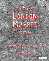
Island: London Mapped Posters
Paperback / softback
Main Details
| Title |
Island: London Mapped Posters
|
| Authors and Contributors |
By (author) Stephen Walter
|
| Physical Properties |
| Format:Paperback / softback | | Pages:72 | | Dimensions(mm): Height 350,Width 280 |
|
| Category/Genre | Poster art |
|---|
| ISBN/Barcode |
9783791383347
|
| Classifications | Dewey:709.2 |
|---|
| Audience | |
|---|
| Illustrations |
34 Illustrations, unspecified
|
|
Publishing Details |
| Publisher |
Prestel
|
| Imprint |
Prestel
|
| Publication Date |
4 September 2017 |
| Publication Country |
Germany
|
Description
Now available in a pull-out poster book, artist Stephen Walter's celebrated hand-drawn map of London is "as much a guide to history and folklore as it is to the geography of the city." (The Guardian) London's streets, built up over more than two thousand years, are a maze of history, cultures, and stories. In his fantastically detailed maps of the city, Stephen Walter converts the densely packed streets into a tangle of insightful yet humorous words and symbols. As The Guardian notes, "the features Walter selects [in a map] are by turns funny, crass, touching, burlesque, murderous and uncanny." Jokingly dismissing neighbouring cities, the artist reimagines London as an insular body of land surrounded by water. The book includes posters of all 33 London boroughs that can be pulled out, framed, and displayed, and a further poster contains a key to the many symbols used by the artist to help readers navigate their way through the maps. Walter's cartographic creations have a cult following and his books enable a wider audience to immerse themselves in his personal vision that celebrates the art of mapmaking and pokes intelligent fun at the city he calls home. AUTHOR: Stephen Walter has exhibited his work around the world and his pieces are in the permanent collections of the Victoria and Albert Museum, the British Museum, and the British Library. 34 Illustrations, 33 of which are detachable posters
Author Biography
STEPHEN WALTER has exhibited his work around the world and his pieces are in the permanent collections of the Victoria and Albert Museum, the British Museum, and the British Library.
Reviews"The features Walter selects are by turns funny, crass, touching, burlesque, murderous and uncanny...And that is the joy of the book, which is as much a guide to history and folklore as it is to the geography of the city." -The Guardian "With a scrupulous attention to detail, Stephen Walter has mapped the City and 32 boroughs in dozens of pencil drawings annotated with illuminating, witty, and sometimes crass commentary, both written and illustrated. His words and symbols reveal not just the physical locale of neighborhoods, but often their social, economic, and political personalities. Rich and imaginative, The Island is a reminder that maps, whether unique cartographic images or mass-produced atlases, are never neutral, always highlighting certain features while keeping others in the dark." -The Boston Globe
|