|
Iceland Adventure Map
Sheet map, folded
Main Details
| Title |
Iceland Adventure Map
|
| Authors and Contributors |
By (author) National Geographic Maps
|
| Physical Properties |
| Format:Sheet map, folded | | Pages:1 | | Dimensions(mm): Height 235,Width 108 |
|
| Category/Genre | Travel maps and atlases |
|---|
| ISBN/Barcode |
9781566955348
|
| Classifications | Dewey:912.4912 |
|---|
| Audience | |
|---|
|
Publishing Details |
| Publisher |
National Geographic Maps
|
| Imprint |
National Geographic Maps
|
| Publication Date |
15 August 2011 |
| Publication Country |
United States
|
Description
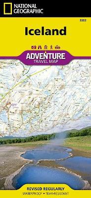
AdventureMaps provide global travellers with the perfect combination of detail and perspective. Iceland's western half is shown on the front side of the map including the cities of Reykjavik, Kpavogur, Mossfellsbaer, and Siglufj rdur. The reverse side covers the eastern portion of the country showing the cities of Akureyri, Egilsstadir, Eskifj rdur, Neskaupstadur, Hsavik, and H fn. Popular locations to ski, golf, camp, fish, and swim are marked, as are World Heritage sites, museums, churches, and other points of interest.
Author Biography
Founded in 1915 as the Cartographic Group, the first division of the National Geographic Society, National Geographic Maps has been responsible for illustrating the world around us through the art and science of mapmaking. Today, National Geographic Maps continues this mission by creating the world's best wall maps, recreation maps, atlases, and globes which inspire people to care about and explore their world. All proceeds from the sale of National Geographic maps go to support the Society's non-profit mission to increase global understanding and promote conservation of our planet through exploration, research, and education.
|