|
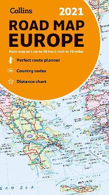
Map of Europe 2021: Folded road map (Collins Road Atlas)
Sheet map, folded
Main Details
| Title |
Map of Europe 2021: Folded road map (Collins Road Atlas)
|
| Authors and Contributors |
By (author) Collins Maps
|
| Series | Collins Road Atlas |
|---|
| Physical Properties |
| Format:Sheet map, folded | | Dimensions(mm): Height 250,Width 140 |
|
| Category/Genre | World atlases and world maps |
|---|
| ISBN/Barcode |
9780008374341
|
| Classifications | Dewey:912.4 |
|---|
| Audience | |
|---|
|
Publishing Details |
| Publisher |
HarperCollins Publishers
|
| Imprint |
Collins
|
| Publication Date |
11 June 2020 |
| Publication Country |
United Kingdom
|
Description
Explore Europe with this full colour road map. A fully revised and updated colour road map of Europe at a scale of 79 miles to 1 inch / 50km to 1cm (1: 5,000,000). Roads, motorways, European Route numbers, railways, airports, cities and towns are clearly shown, making the map ideal for route-finding and planning journeys. Main features * Fully revised and updated * Full index to place names (on reverse of sheet) * Distance chart giving distances in kilometres between main towns * European Union map showing member states and the Eurozone * Internet links to further information on Europe Area of coverage Covers the whole of Europe from the North Cape (Norway) to Gibraltar and from Ireland to east of Moscow. Also includes Iceland and Cyprus. * Key to approved country code abbreviations - GB, F, D etc. * Map key in English, French, German, Spanish and Italian
Author Biography
Explore the world through accurate and up-to-date mapping.
|