|
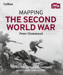
Mapping the Second World War: The history of the war through maps from 1939 to 1945
Hardback
Main Details
| Title |
Mapping the Second World War: The history of the war through maps from 1939 to 1945
|
| Authors and Contributors |
By (author) Peter Chasseaud
|
|
By (author) The Imperial War Museum
|
|
By (author) Collins Books
|
| Physical Properties |
| Format:Hardback | | Pages:304 | | Dimensions(mm): Height 271,Width 227 |
|
| Category/Genre | Second world war |
|---|
| ISBN/Barcode |
9780008136581
|
| Classifications | Dewey:940.5309 |
|---|
| Audience | |
|---|
|
Publishing Details |
| Publisher |
HarperCollins Publishers
|
| Imprint |
Collins
|
| Publication Date |
8 October 2015 |
| Publication Country |
United Kingdom
|
Description
Follow the conflict of the Second World War from 1939 to 1945 in this unique volume, published in association with Imperial War Museums, London, featuring historical maps and photographs from their archives, and fascinating commentary from an expert historian. Over 150 maps tell the story of how this global war was fought. Types of maps featured: * Strategic maps showing theatres of war, frontiers and occupied territories * Maps covering key battles and offensives on major fronts * Planning and operations maps showing defences in detail * Propaganda and educational maps for the armed forces and general public * Maps showing dispositions of Allied and enemy forces * Bomber and V-weapon target maps Descriptions of key historical events accompany the maps, giving an illustrated history of the war from an expert historian. Key topics covered include * 1939: Invasion of Poland * 1940: German invasion of Low Countries & France * 1940: Battle of Britain & German invasion threat * Dec 1941: Pearl Harbor * 1942: Turning points: Midway, Alamein, Stalingrad * 1941-45: Barbarossa and the Eastern Front * The War at Sea * The advances to Jerusalem, Damascus and Baghdad * The War in the Air * 1944: Neptune & Overlord; D-Day & liberation of France
Author Biography
A historian of military cartography, a Fellow of the Royal Geographical Society, the founder of the Historical Military Mapping Group of the British Cartographic Society, a member of the Defence Surveyors' Association, the Royal United Services Institute (RUSI) and author of definitive works on trench mapping and toponymy.
Reviews'Beautifully produced book that will interest military historians and map lovers alike' - Who Do You Think You Are magazine 'Expert commentary and a fresh perspective on the events of the war' - Family Tree Magazine 'Mapping the Second World War draws on the remarkable maps of IWM's unparalleled archive to offer a new perspective on the conflict's key moments' - Antiques Diary
|